
More than $300 billion is already being spent on big data analytics, and its vast scope in terms of investment is down to how broadly this technology can be applied to the challenges facing humanity. This significant financial commitment underscores the urgent need for innovative solutions that leverage data to improve quality of life, optimize resource management, and address critical issues such as climate change and urbanization.
From an urban planning perspective, there’s a lot that big data has to offer, which is particularly noteworthy. It enables planners to make informed decisions based on real-time data analysis, ultimately leading to more efficient infrastructure development. Additionally, big data facilitates enhanced citizen engagement, allowing communities to voice their needs and preferences, which can be integrated into planning processes. As a result, the application of big data not only streamlines urban development but also fosters a more inclusive environment where diverse perspectives are considered in shaping city futures.
Let’s explore how big data is being utilized in urban planning and examine its significance for the 4.4 billion people residing in cities around the world. This overview will highlight the practical applications of big data and the positive impacts it has on urban living.

Transforming Traffic Management
Traffic is a national problem, with commuters losing 42 hours to jams last year on average. This is not just about individual frustration but also the economic and environmental impact, making effective congestion management a must for urban planners.
The good news is that this process is able to evolve faster and adapt quicker with the help of data insights. Cities can utilize big data to alleviate congestion, improve safety, and reduce emissions.
For instance, predictive analytics is a means of modeling traffic patterns. This lets planners adjust signals and lanes for optimal flow during rush hours or special events.
Sensor networks play a key role here as they can:
- Detect vehicle volume in real-time
- Adjust signal timing dynamically
Public transit apps also harness real-time information for route optimization. Commuters gain alternatives when delays hit public transportation systems.
Artificial intelligence further boosts efficiency by analyzing historical data to foresee incidents before they occur. This proactive approach lessens the impact of potential gridlocks.
One innovative example comes from Singapore’s Intelligent Transport System, which has integrated these technologies effectively for the past 23 years. Urban planners can manage dense traffic seamlessly with predictive strategies that continuously learn while preparing to roll out autonomous vehicles and other new solutions going forward.
Urban areas investing in similar systems will likely find significant improvements in daily commutes, leading to enhanced quality of life and economic growth opportunities as time goes on.

Building Smart Cities
The smart city concept is taking off, transforming how we live. It’s a way of making urban areas more efficient by integrating technology into infrastructure and services.
For example, IoT devices collect data across multiple sectors like transportation, energy, and waste management. This information optimizes resource allocation and service delivery.
As a result:
- Energy grids get smarter by distributing power based on real-time demand.
- Sensors in trash bins signal when collection is needed to streamline waste removal.
Case studies highlight success stories like Barcelona’s use of IoT for parking optimization. Motorists are directed to available spaces with minimal effort. Big data also aids city planners in creating green spaces that improve air quality while providing recreational areas for residents.
Individuals interested in building a career within the expanding field of smart cities should consider enrolling in a Master of Science in Data Intelligence and GeoAnalytics program. This program offers practical training and essential hands-on technology skills. These qualifications will equip you to thrive in a professional environment that increasingly demands expertise in data-driven urban development.

Harnessing Predictive Modeling for Infrastructure Development
Predictive modeling is not just useful for traffic management. In fact, it can be applied to the planning of infrastructure development across urban regions, as it anticipates needs and trends, guiding resource allocation and project prioritization.
For instance, through big data analytics it’s possible for urban planners to forecast population growth, migration patterns, and housing demands. This helps ensure developments align with future city dynamics. Given that 1 billion people are expected to be displaced by a combination of these factors if action is not taken, it’s clear that this is an issue requiring action.
Key applications of predictive modeling include:
- Anticipating maintenance needs to prevent costly repairs.
- Projecting utility consumption rates to guide energy infrastructure investments.
London exemplifies this approach by using models to manage its complex transportation network. Insights gleaned from data allow for strategic expansions that cater to anticipated commuter increases.
Cities are increasingly leveraging predictive tools not only for efficiency but also for sustainability. This includes designing eco-friendly buildings informed by simulations of environmental impacts over time. Such practices underscore the potential of these technologies in creating resilient urban landscapes that meet long-term societal needs while fostering sustainable growth strategies well into the future.
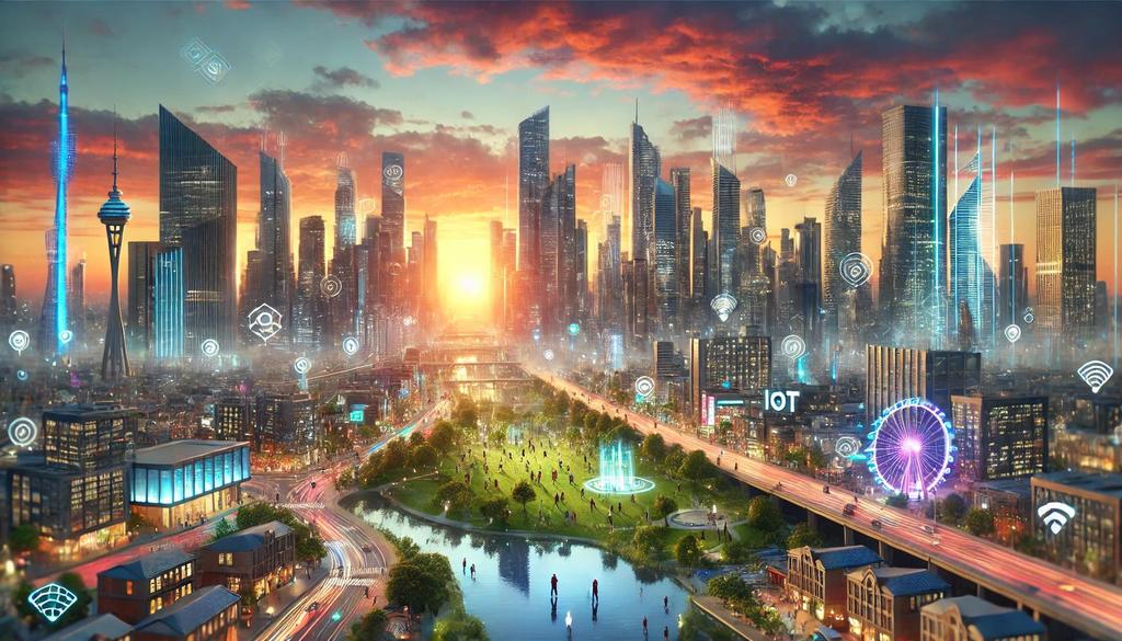
Big Data in Urban Planning: A Gateway to Sustainable Futures
Big data plays a crucial role in urban planning. Its benefits are clear and far-reaching. Professionals who possess the skills and experience to utilize these tools will find themselves on a path to a successful and enduring career. Moreover, their expertise will contribute significantly to our society’s advancement and future generations’ well-being.
As we embrace the full potential of big data in urban planning, we pave the way for cities that are smarter and more responsive to the needs of their inhabitants. By harnessing innovative technologies, urban planners can create environments that prioritize the well-being of citizens while addressing pressing challenges such as traffic congestion, resource distribution, and sustainability. Ultimately, investing in data-driven strategies enhances urban living and supports a collective vision of progress and resilience that future generations will inherit.


