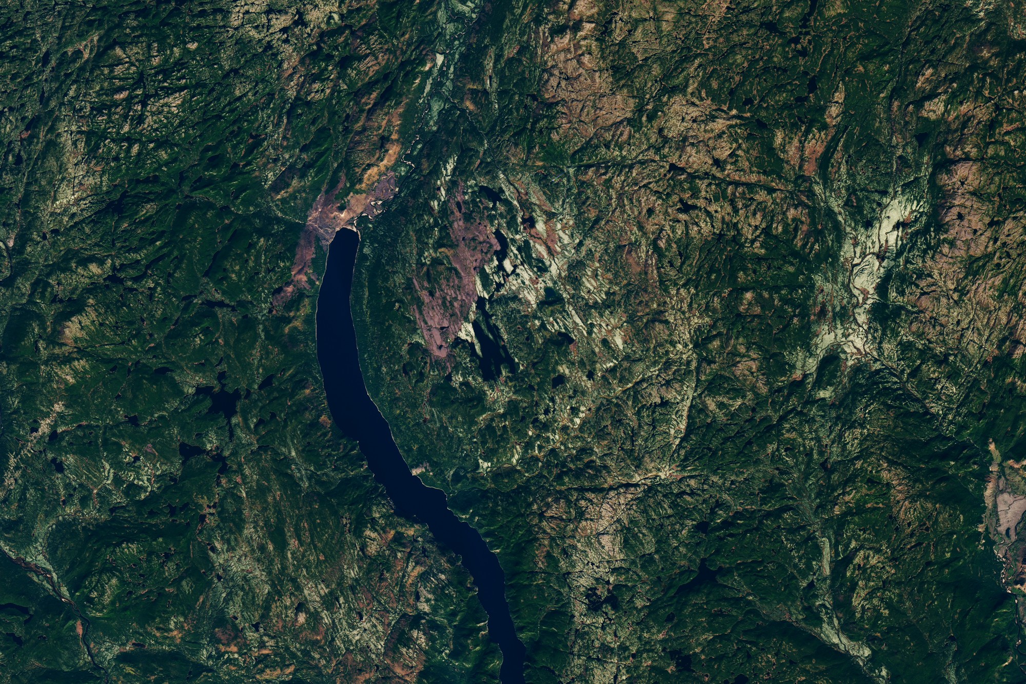
In September 2026, something that had never happened in the modern history of the American West finally happened. Lake Powell, the second-largest reservoir in the United States, fell to a level it has never reached in the decades since it was created. The Bureau of Reclamation recorded the lake at 3,517.24 feet above sea level, breaking the previous record of 3,519.92 feet set on 13 April 2023.
That figure is the headline. It is also, on its own, misleading. Lake Powell is not one foot below its own all-time low, or even thirty. It is sitting at roughly 22% of its total capacity, in a state that federal hydrologists describe with a phrase borrowed from dam safety: a megadrought that has now run for a quarter of a century.
So the honest question is not whether the record is real. It plainly is. The useful question is what it actually means for the millions of people whose water and electricity pass through these two concrete walls and for the 186-mile canyon that reappears beneath the surface every time the lake falls this far.
What Record Lake Powell Just Broke
Lake Powell first crossed its previous record low on 15 August 2026. It kept falling through late August and into early September, reaching 3,517.24 feet in Landsat imagery acquired on 10 September 2026. Compare that with the 3,519.92 feet set on 13 April 2023: the lake is not marginally lower; it is two and two-thirds feet lower than any previous modern reading.
The two reservoirs that anchor the Colorado River system both set records within about two weeks of each other in August 2026. That had not previously happened, and it produced a figure that researchers had been waiting decades to see.
Reclamation’s weekly Lower Colorado hydrologic update for 20 September 2026 put Powell at 3,517.21 feet, having gained roughly a third of a foot in the preceding week, with total system contents across the Colorado River at about 31% of capacity.
The elevations that matter, side by side
Four numbers frame this entire story. Three of them are historical. One of them is a deadline.
| Elevation (feet) | What it means | Status |
|---|---|---|
| 3,700 (full pool) | The lake at its designed maximum capacity, 24.3 million acre-feet | Currently 182 feet below this |
| 3,519.92 | Previous record low, set 13 April 2023 | Broken 15 August 2026 |
| 3,517.24 | Record low recorded 10 September 2026 | Current record |
| 3,510 | Interior’s operating target to protect Glen Canyon hydropower | Only 7 feet of headroom left |
| 3,490 | Minimum power pool: water can no longer be released through the penstocks | Approached but not breached |
| 3,370 | Dead pool: no water can leave the reservoir | 147 feet below current level |
Read that last column and the real story emerges. Powell sits only about seven feet above the elevation at which the Interior Department has committed to holding the reservoir to keep Glen Canyon Dam generating power and about twenty-seven feet above the minimum power pool.
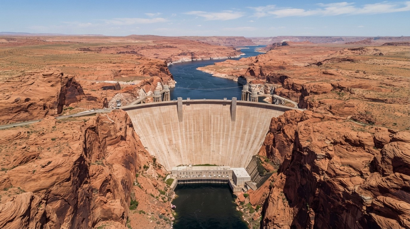
This is the point most coverage of the record missed. The record low is real, and it is symbolic, but the operational crisis threshold has not been crossed. For now, the lights stay on.
A senior research scientist at Utah State University’s Center for Colorado River Studies put it plainly when the records fell: “These are truly unprecedented. We are in completely new territory.”
Is Lake Powell Really Low? The 22% Paradox
Here is the number that should stop people cold, and it is almost never mentioned in news write-ups: on 8 September 2026, Lake Powell was 22% full.
Not 78% empty in some marginal sense. Genuinely one-fifth full. Live storage sits at roughly 5.1 million acre-feet, against a total capacity of about 24.3 million acre-feet. Reclamation’s August 2026 24-month study projects Lake Powell ending water year 2026 near 3,515.89 feet, with about 5.03 million acre-feet in storage. That figure is the one to watch: the study puts Powell below the 3,510-foot protection line during water year 2027, which would end the drought-driven emergency measures now in place.
[interactive_chart]{“type”:”column”,”themeMode”:”light”,”background”:”#f8fafc”,”title”:”Lake Powell at 22% of Capacity”,”subtitle”:”Live storage against total reservoir capacity of 24.3 million acre-feet, September 2026″,”source”:”U.S. Bureau of Reclamation; Western Water”,”sourceUrl”:”https://lakepowell.water-data.com/LP_WaterDB_printable.php”,”unitSuffix”:”%”,”dataLabels”:true,”categories”:[“Current storage (8 Sep 2026)”,”Remaining capacity”],”series”:[{“name”:”Share of total capacity”,”data”:[22,78]}],”colors”:[“#0e7490″,”#cbd5e1″],”yAxis”:{“title”:”Percent of capacity”},”allowDownload”:true}[/interactive_chart]
That chart is worth pausing on. The pale bar is not drought damage that could be repaired. It is the structural reason this situation exists: a reservoir sized for a snowpack that no longer arrives, on a river whose flow has been declining for a quarter of a century.
What Caused the 2026 Collapse: Snow Drought
Most of the Colorado River’s flow begins as snow at high elevation, melting in spring and early summer. In 2026, that snow largely did not arrive, and what did arrive melted early.
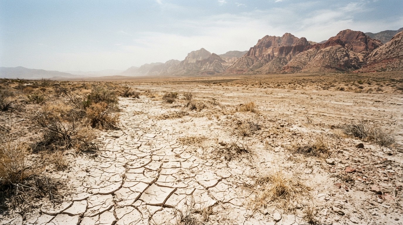
The Upper Colorado Basin received unusually little accumulation during the winter of 2025 and 2026, which the National Drought Resilience Center defines as a snow drought. Stretches of record warmth then sapped what snowpack existed. When spring arrived, seasonal snowmelt delivered a relative trickle to Lake Powell instead of the annual refill the reservoir depends on.
By summer, the effect had propagated all the way down to Lake Powell. Inflows dwindled, and the lake fell to record levels in late August and early September 2026.
NASA’s Earth Observatory, which published Landsat 8 imagery of the change, frames this as a direct expression of a 21st-century megadrought: drought in the US Southwest that has been continuous since roughly the start of this century. Satellite-based tools such as the Western Land Data Assimilation System, which blends Landsat observations with modelled data, allow the decline to be tracked basin-wide rather than inferred from a handful of gauges.
The Navajo Nation has its own stake in this and its own drought tools. A drought severity evaluation tool originally co-developed with the Navajo Nation was expanded in 2025 to cover the Chickasaw and Choctaw Nations in Oklahoma, because water forecasting on this river is not merely a technical exercise for the states that hold the largest paper rights.
Lake Mead Also Set a Record, and It Is Closer to Dead Pool
Lake Mead, the largest reservoir in the country, hit its own record low on 7 August 2026, reaching about 1,040.5 feet above sea level. That edged past the previous modern record of 1,040.58 feet, set in July 2022, which had itself followed an earlier record in 2007.
Mechanics matter more here. Hoover Dam runs 17 main turbines, and only five are newer wide-head units designed for low water. The threshold to watch is 1,035 feet, the optimal elevation for hydropower production at Mead. Below it, older turbines risk severe cavitation damage and must come offline. Reclamation’s updated operational data indicate that at 1,035 feet, Hoover Dam’s capacity could drop from earlier estimates of 1,302 megawatts to about 382 megawatts, a cut of roughly 70%.
The real threshold is 1,035 feet, the optimal elevation for hydropower production at Mead. Below it, older turbines risk severe cavitation damage and must come offline. Dead pool for Mead sits far lower, at 895 feet, below which the dam can no longer release water downstream at all. Between 895 and 950 feet is the inactive pool, where releases can occur but generate no hydropower.
Mead was about five feet above the 1,035 threshold at the time of the record, and Reclamation is spending $52 million on three replacement wide-head turbines able to operate down to about 950 feet, which would soften but not eliminate the cliff. Powell, notably, is in the more precarious position of the two, because Glen Canyon’s minimum power pool of 3,490 feet is close relative to where the lake now sits, and Reclamation’s 3,510-foot target is only seven feet away.
Perhaps the most under-reported figure in the whole story: combined live storage in Lakes Mead and Powell reached 12,675,509 acre-feet on 12 July 2026, the lowest combined total since May 1957, according to analysis from the University of Colorado Boulder’s Colorado Water Center. In May 1957, there was no Lake Powell at all. Glen Canyon Dam’s diversion tunnels had not closed until March 1963.
Combined storage has since been depleted at roughly 16,000 acre-feet per day since March 2026, dipping to about 11,000 per day in May when snowmelt and supplemental releases from Flaming Gorge briefly slowed the decline. Researchers have warned that every day going forward is likely to set a new combined record low until the 2026 and 2027 winter snowpack begins to arrive in spring 2027.
The 7-Foot Buffer: Why Glen Canyon’s Lights Are Still On
This is the most important operational fact in the story, and it is the one most often left out.
Interior’s 2027 to 2028 operating guidelines establish a minimum elevation of 3,510 feet at Lake Powell to support continued operational reliability at Glen Canyon Dam. That is not a scientific threshold. It is a policy decision, made in the knowledge that below it, power generation becomes unreliable.
Lake Powell is currently about seven feet above that line. The 3,490-foot minimum power pool is roughly 27 feet below the current surface.
So when Reclamation makes release decisions, it is genuinely balancing two objectives in tension: protect downstream users in Arizona, Nevada, and California, and avoid crossing an elevation at which the dam’s turbines stop working effectively. The record low and the power question are not separate stories. They are the same story.
[interactive_chart]{“type”:”bar”,”themeMode”:”light”,”background”:”#f8fafc”,”title”:”How Much Room Is Left Below Lake Powell”,”subtitle”:”Feet of elevation remaining before each operational threshold is reached”,”source”:”U.S. Bureau of Reclamation; NASA Earth Observatory”,”sourceUrl”:”https://science.nasa.gov/earth/earth-observatory/lake-powell-drops-to-record-low-levels/”,”unitSuffix”:” ft”,”dataLabels”:true,”categories”:[“To 3,510 ft operating target (protection line)”,”To 3,490 ft minimum power pool”,”To 3,370 ft dead pool (no release possible)”],”series”:[{“name”:”Feet of headroom remaining”,”data”:[7,27,147]}],”colors”:[“#0e7490″],”xAxis”:{“max”:150,”tickAmount”:5},”allowDownload”:true}[/interactive_chart]
The first bar is the number to watch through the winter. If Powell falls below 3,510 feet, the operational response changes character entirely.
What Happens Next: 1.25 Million Acre-Feet of Cuts
On 21 August 2026, the Department of the Interior issued the 2027 to 2028 Operating Guidelines and the Record of Decision for the Post-2026 Colorado River Operations Final EIS, establishing a ten-year decision framework for both reservoirs.
Under the new guidelines:
- Releases from Lake Powell are determined by actual hydrology, with a stated goal of maintaining a minimum elevation of 3,510 feet
- Lower Basin deliveries are reduced by 1.25 million acre-feet in each of 2027 and 2028
- Lower Basin states are asked to voluntarily conserve and store at least 700,000 acre-feet over the two-year period, in addition to those cuts
- The framework is reviewed in two-year periods, and deeper reductions could follow if basin conditions worsen
- Upper Basin states face no mandatory reductions, though they may be asked to operate Aspinall, Flaming Gorge and Navajo reservoirs to help protect Glen Canyon Dam infrastructure
If the three Lower Basin states implement the sharing agreement they proposed in May, the reductions divide as follows.
| State | Annual reduction (acre-feet) | Share of total |
|---|---|---|
| Arizona | 760,000 | 60.8% |
| California | 440,000 | 35.2% |
| Nevada | 50,000 | 4.0% |
| Total | 1,250,000 | 100% |
That is a combined reduction of roughly 21% of Lower Basin water supply in 2027 and 2028, and it is the first time the federal government has imposed mandatory reductions on these states. Arizona, which holds the largest paper rights and takes the deepest physical cuts from Lake Mead, absorbs more than three-fifths of the reduction. The trend has been building for years, and IL has covered how climate change is drying out the Colorado River since 2020.
One acre-foot is 325,851 gallons. Historically that was enough to serve two families in California for a year; by 2018, with many people using less water, the Metropolitan Water District of Southern California reported it was enough for about three homes. The volume is not abstract.
What Town Is Under Lake Powell?
Of all the questions people ask about this story, the one with the least coverage is the most human: what is down there?
When Glen Canyon Dam’s gates closed in 1963, the rising reservoir flooded a 186-mile stretch of canyon. It drowned a sandstone landscape that explorers had compared to a cathedral, along with named features like Cathedral in the Desert, Music Temple, Gregory Natural Bridge, and the Crossing of the Fathers. Roughly 2,000 documented archaeological sites went under.
It also drowned a working town. Prospector Cass Hite had reached this remote stretch of the lower Colorado in 1880 chasing gold, and found a natural ford he named the Dandy Crossing. The settlement of Hite grew beside it: a post office, a ferry, a handful of buildings serving miners and travellers in some of the most isolated country in the lower 48. The town site was submerged in the 1960s.
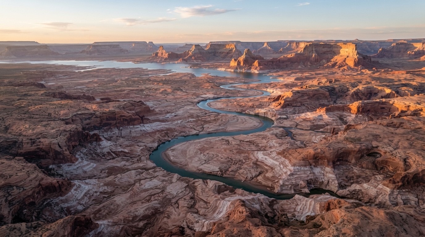
And it comes back. At the 2023 record low, the upper reservoir receded enough to expose much of that reach again, revealing the old Hite area near the waterline. At the 2026 low, that exposure is greater still.
This is not a curiosity. It is a recurring, predictable consequence of the drought cycle, and it is one of the few genuinely hopeful details in a grim story: a landscape returning to the surface because the water withdrew from it.

Drought has also revealed other submerged structures elsewhere in the basin. New Mexico’s Elephant Butte Reservoir, at 1.4% of capacity in July 2026, exposed long-submerged debris and infrastructure in a way that reshaped local understanding of the Rio Grande’s history.
The Emergency Steps Reclamation Took
Managers did not wait for the record. Beginning in April 2026, the Bureau of Reclamation acted to protect the system:
- Released additional water from Flaming Gorge Reservoir in northern Utah and southern Wyoming into the Upper Colorado system
- Reduced releases from Lake Powell into Lake Mead to preserve storage upstream
- Canceled an April controlled flood intended to rebuild sandbars critical to fish habitat below Glen Canyon Dam
- Skipped an August “cool mix” release designed to protect native species, in order to conserve stored water
Lake Powell will begin the 2027 water year, on 1 October 2026, at an elevation between 3,540 and 3,510 feet, placing operations in what Reclamation calls the Lower Elevation Infrastructure Protection Range, with an expected release of 6.0 to 7.0 million acre-feet.
That last pair of decisions deserves attention. Both sacrificed ecological objectives, on the Glen Canyon Dam river, to protect water supply. Sandbars that build salmon and native fish habitat are downstream features; the fish that use them are among the most imperiled in the basin.
Researchers studying halted dam releases have warned that these ecosystem consequences are not a side effect. They are part of the calculation, and the longer water levels stay low, the longer those releases stay suspended.
What This Means for You
Lake Powell and Lake Mead together sustain 5.5 million acres of farmland and agricultural communities across the West, and supply cities including Las Vegas, Phoenix, Los Angeles and San Diego, serving more than 40 million people in total. The Colorado River is a vital resource for 30 tribes and two Mexican states, and generates hydropower for seven states. It is not a remote environmental statistic.
- Water deliveries will tighten before they cut deeply. The 700,000 acre-foot voluntary conservation target means states may ask cities and farmers to reduce use before mandatory cuts bite.
- Power is the quieter risk. Every foot of elevation lost is power not generated, and Powell is closer to its protection line than Mead is to its turbine threshold.
- There is no new rain to fix this. Reclamation describes 26 years of unprecedented multidecadal drought, worsened by the lowest observed snowpack on record this past winter. A single good winter would slow the trend; it would not reverse it.
- Combined storage is the metric that matters. Individual records are striking, but the system-level total falling below 1957 levels is the number that should govern planning.
Frequently Asked Questions
Is Lake Powell the lowest it has ever been?
It is the lowest in its modern history, which means since it began filling in 1963. The lake reached a record low on 15 August 2026 and fell to 3,517.24 feet by 10 September 2026, breaking the 3,519.92 feet record set in April 2023.
Is Lake Powell really low right now?
Yes, and this is the detail most reports omit: at roughly 22% of total capacity, the lake is about one-fifth full, with live storage near 5.1 million acre-feet. Reclamation’s August 2026 study projects the lake ending water year 2026 near 3,515.89 feet and dropping below the 3,510-foot protection line during water year 2027.
Is this Colorado’s worst drought?
It is the longest. Drought in the Southwest has been continuous since about the start of the 21st century, which hydrologists call a megadrought. What made 2026 exceptional was the snow drought: an exceptionally weak 2025 and 2026 mountain snowpack combined with record warmth that accelerated melt.
What town is under Lake Powell?
The town of Hite, Utah, a river settlement with a post office and ferry established near a natural ford after prospector Cass Hite arrived in 1880. It was submerged in the 1960s and re-emerges when the reservoir falls to these levels. About 2,000 archaeological sites across Glen Canyon are also submerged.
Will Glen Canyon Dam still generate electricity?
For now, yes. Lake Powell remains roughly 27 feet above the 3,490-foot minimum power pool, and Interior’s 2027 to 2028 guidelines set a 3,510-foot minimum to protect reliable generation. Powell is only about 7 feet above that protection line.
How much water are California, Arizona and Nevada losing?
1.25 million acre-feet in each of 2027 and 2028, roughly a 21% reduction in Lower Basin supply. Arizona takes 760,000 acre-feet, California 440,000 and Nevada 50,000, assuming the states implement their proposed sharing agreement.
Conclusion
Lake Powell has set a record low, and that record will probably not stand for long. Reclamation’s August 2026 study projects the lake ending water year 2026 near 3,515.89 feet and falling below the 3,510-foot protection line during water year 2027, while combined Mead and Powell storage has been depleted at roughly 16,000 acre-feet a day since March.
What the records do not mean is that the lights go out tomorrow. The operational thresholds that matter most are still intact, and Reclamation has both the tools and the legal authority to hold the line for now. The July 2026 decision to prioritize protecting Lake Powell over releasing ecological flows below Glen Canyon Dam shows how those trade-offs are already being made.
What the record does mean is that there is very little margin left. Twenty percent of capacity is not a drought. It is a structural mismatch between a reservoir designed for one climate and a river now running in another. The town of Hite coming back to the surface is the most legible symbol of that mismatch, and the least frightening of the consequences.