
NASA’s Mars Reconnaissance Orbiter discovered a mineral-rich area of Mount Sharp years before the 2010 landing of the Curiosity rover. Since then, scientists have eagerly awaited a closer look at the terrain.
According to a NASA news release, more than a decade after landing on Mars, the Curiosity rover has finally reached the “sulfate-bearing unit” of Mount Sharp. The “long-sought” region, rich in salty minerals, was hypothesized to have formed as Mars’ climate dried out.
When the rover landed, it found a variety of rocks and signs of past water. In addition, there were salty minerals like magnesium sulfate (such as Epsom salt), calcium sulfate (including gypsum), and sodium chloride (like table salt). Scientists hope that the minerals will shed light on how and why Mars’ climate shifted from being more like Earth’s to its current desert state.

The “Canaima” Drill Sample
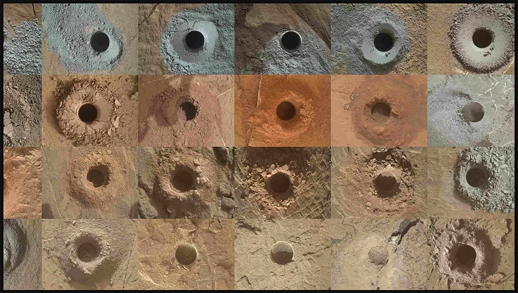
The scientists selected a rock called “Canaima” as the 36th drill sample for the project. The rover pulverized rock samples for examination using a percussive rotating drill at the end of its two-meter (seven-foot) arm. “As we do before every drill, we brushed away the dust and then poked the top surface of Canaima with the drill. The lack of scratch marks or indentations indicated that it might prove difficult to drill,” explained Kathya Zamora-Garcia, Curiosity’s new project manager from NASA’s Jet Propulsion Laboratory in California.
The mission’s scientists will examine parts of the sample using the Sample Analysis at Mars instrument and the Chemical and Mineralogy instrument.
The Rover Travelled Over A Month to Reach the Sulfate-Rich Area
Curiosity had to navigate rugged terrain to reach the sulfate-rich region, including the sandy “Paraitepuy Pass” this past August. It took the rover more than 30 days to get safely to its destination.
The press release highlighted the following:
“While sharp rocks can damage Curiosity’s wheels (which have plenty of life left in them), and can be just as hazardous, potentially causing the rover to get stuck if the wheels lose traction. Rover drivers need to navigate these areas carefully.”
As the hills obstructed Curiosity’s view of the sky, it had to be cautious while orienting itself to direct its antennas toward Earth and communicate with passing orbiters. After Curiosity had found its proper position, the rover’s Mast Camera, or Mastcam, was used on August 14 to record some of the “most inspiring” landscapes of the mission.

A New Phase Brings New Obstacles
Curiosity’s science operations coordinator, Elena Amador-French of JPL, who oversees collaboration between the engineering and science teams, said:
“We would get new images every morning and just be in awe. The sand ridges were gorgeous. You see perfect little rover tracks on them. And the cliffs were beautiful – we got really close to the walls.”
However, the rover is now facing a new set of difficulties. Curiosity struggles to find a location where all six wheels are on stable ground due to the more rugged terrain. According to Amador-French, “the more and more interesting the science results get, the more obstacles Mars seems to throw at us.”


